While Google Earth is great, there are few other options that can help you do the same things. Many users are not happy with Google’s data collection policies and don’t want to hand over data more than they have to. If for that reason or a reason of your own, you are searching for Google Earth alternatives then you have come to the right place. Here are the 4 best apps like Google Earth you can use in 2020.
Best Google Earth Alternatives (Updated October 2020)
Here are apps and programs similar to Google Earth that you can use to your advantage. You can click on the link below and move to the apps seamlessly.
Top Alternatives to Google Earth
1. Zoom Earth
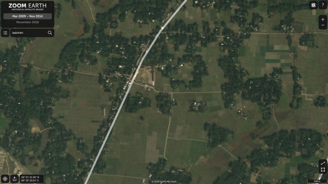
Zoom Earth is one of the best alternatives to Google Earth solely because it does not use much of Google’s services for data mapping and yet offers great imagery of our Earth. Similar to Google Earth, Zoom Earth is web-based and it shows real-time information of weather, storms, wildfires, and more. The best part is that you can see high-resolution aerial views of the many places in a zoomable map. I have been using Google Earth for the past many years and it seems Zoom definitely offers a better image quality. Further, just like Google Earth, Zoom Earth also allows you to see the history of imagery of a certain place. I was able to see aerial images of 2002 of my region which is just amazing and the image quality was again surprisingly better than Google Earth.
If you are wondering about data input then here are the sources Zoom Earth uses to simulate Earth in real-time. For live weather imagery, it uses NOAA GOES (Geostationary Operational Environmental Satellite) which is administered by NASA. It also uses data from Japan’s and EU’s satellites. For daily images, Zoom Earth primarily uses NASA’s GIBS service and for historical imagery, Microsoft and Esri come to help. Simply put, Zoom Earth is a non-Google service that is really as good as Google Earth in terms of aerial imagery and you should definitely give it a shot. Key Features: High-quality aerial view, Real-time Earth simulation, Weather, storm and wildfire information, Data sourced from reliable organisations Platform Availability: Web Price: Free Visit Website
2. NASA World Wind
If something bears the name and backing of the space agency of the United States, there’s nothing doubting the fact that it’ll be good. And as such, the open-source NASA World Wind is one of the best Google Earth alternatives you can find. It’s worth noting that NASA World Wind is a Java-based Software Development Kit, primarily targeted at developers, who can use it to create applications using data (satellite imagery, topographic maps etc.) provided by NASA and USGS.
From zoom to tilt, different types of controls are supported, and there’s a sizeable collection of high-resolution imagery. The database contains millions of place names, political boundaries, and even latitude/longitude lines. Also, there are numerous plug-ins and add-ons, which can be used to add features like camera controlling scripts, and XML files displaying place-marks as icons. All these advanced features make NASA World Wind the best alternative to Google Earth Pro (desktop version). Key Features: Open-source project, Maintained by NASA, High-resolution imagery of Earth, Import data in XML, Best for developers Platform Availability: Windows, macOS, Linux Price: Free Download
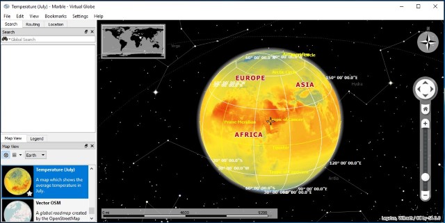
3. Marble
No matter what place on Earth you want to check out, Marble will help you out with it. The robust Google Earth alternative has multiple viewing modes, which can be used to view the Earth as not only a 3D globe, but also highlight its topographical features, street views, and even temperature and precipitation data. This is further enhanced by information like photos, real-time traffic updates, and online/offline address search. In fact, Marble also has routing and turn-by-turn navigation (both online and offline) features.
The application itself is fairly lightweight, as it ships without any extra data-sets. However, the same can be easily fetched via in-app downloads. There are even data-sets that let you view virtual models of the moon and other planets. You can also follow satellites and space stations orbits, which are updated in real-time. Add to it, there are many useful tools like time simulation, bookmarks, etc., that make Marble even better. Key Features: Topographical information of Earth, Access Street View, Easy navigation, Virtual models of the moon and other planets, Follow satellites in real-time Platform Availability: Windows, macOS, Linux Price: Free Download
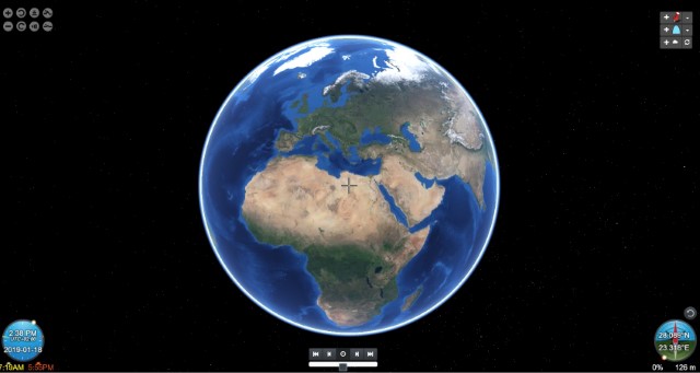
4. Google Street View
One of the biggest features of Google Earth is that it allows you to see high-quality 3D view of popular places such as the Eiffel Tower, Mount Everest, the Taj Mahal, and more. Google has specifically identified these popular places and mapped aerial images and 3D data points to give you a virtual tour of that place. You can get a similar experience and even more with Google Street View. Yes, it’s another Google service with an almost similar objective, but as the name suggests, it remotely takes you to the streets of many places (not just popular) around the globe. I have used this service in the past and Google Street View has been able to show around places in a great 360-degree panoramic view.
Just like Google Earth, this can bring faraway places to your smartphone and make you feel closer to the places that you want to visit. That said, keep in mind, in India, the government didn’t allow Google to capture street data so you won’t find street view of many places, other than the user-generated ones. But for the rest of the world, you can enjoy street views of places all across the globe. You can learn more about Google Street View from our article on the best Google Maps tips and tricks. Key Features: Street View around the world, 360-degree panoramic view, VR-compatible, Get closer to your favorite places Platform Availability: Android, iOS Price: Free Download: Android (Free), iOS (Free)
Q. Is There Another App like Google Earth?
While there is no full-fledged Google Earth alternative that covers all the features, you can take a look at Zoom Earth. It offers excellent aerial views around the world and in fact, the image quality is better than Google Earth.
Q. Which Google Earth Version is Best?
All Google Earth Versions are great, but if you have got a PC then go ahead and download the desktop version for better rendering. Other than that, the web version is also pretty good and capable of rendering the Earth Engine.
Q. Is There a Google Earth in Real-time?
Google Earth does not offer a real-time view, but if you want one then just go for Zoom Earth. It offers real-time imagery, weather information, storm, wildfire, and much more from places around the world. It also gives you information such as wind speed, pressure, etc.
Q. Can You Use Google Earth Without Downloading It?
Yes, you can use the web version of Google Earth without downloading it. Just click on this link and you will be taken to Google Earth Web.
Q. How Far Back Can Google Earth Go?
You can go as far as 1984 to get an aerial view of Earth. Google introduced this new feature called Google Earth Timelapse where you can track the changes from 1984 to the present. Head over to this webpage to find more information,
Visit Places Virtually With These Alternatives to Google Earth
It’s true that Google Earth is the undisputed leader when it comes to viewing 3D virtual representations of the Earth, and the many natural landscapes, man-made cities that our planet is home to. However, as seen above, Google Earth is not the only one out there. So check out these alternatives to Google Earth, and let us know your thoughts in the comments section below.